
The original (2013) copy. Subject to upgrades in 2020.
DFC pdf final master.pdf
Adobe Acrobat document [19.3 MB]
Defined Flying Challenges
in the Lakes, Dales & Pennines
(subject to update 2026)
First of all, this is not a book aimed at skygods, nor is it in any way a site guide. At its core is PILOT DEVELOPMENT.
The main aim is to provide a set of flying challenges that can be attempted on, and from some of the best flying sites in the UK. In other words, the hills of the Lake District, Yorkshire Dales and the Pennine plus out-lying regions around the Trough of Bowland/Ribble Valley. It is designed to add a little spice and focus to a day's flying.
It is also a good introduction to the use of GPS navigation, regardless of whichever instrument or app is used. Fluent and confident GPS skills have benefits in terms of general xc and competition flying - in both cases you need to know where you are to stay legal, and where you're going to achieve your best.
The routes are roughly equally spread across four gradings, making the easiest well within the capabilities of competent CP rated pilots. For those wishing a wider view than their local club sites, then it opens up neighbouring areas to a more informed visit. If you have a higher pilot rating, the harder challenges await and are a good way of learning even more about weather, flying conditions and provide a deeper understanding of yourself, your wing or an area/site.
If you put all of the above together, you could say it's aimed at the majority of us strivers and wannabees. Essentially, it's about pilot development.
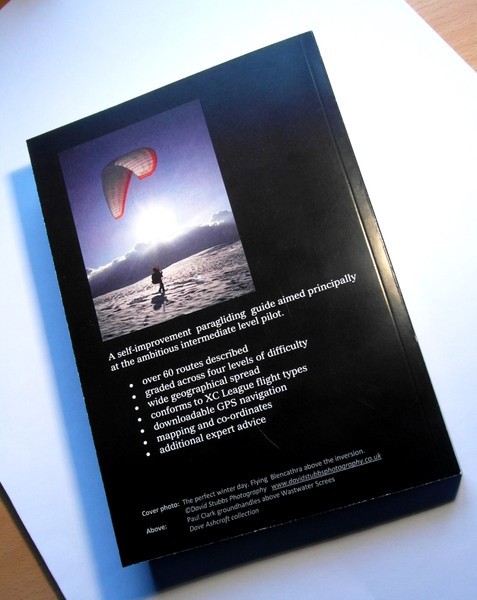
DFC is a relatively new concept which lays out in detail over 60 defined routes covering the Lakes, Dales and Pennine areas. There are several route types, such as triangles (FAI and flat), out and returns, or flights to a set goal via turnpoints. It is accessible to all levels of pilot with routes being graded for optimum conditions and with advice on, safety, weather and providing co-ordinate details in both manual and downloadable forms. They can be downloaded in various formats from XCMAP
" ...... focused challenges at all levels ...."
In an attempt to be more than a rather dry paragliding route guide, within almost 200 pages it provides a comprehensive introductory set of guidance notes that lays out in detail the grading system, route types, suitability for pilot levels and touches on GPS use and flight analysis.
" ...... practice in GPS use; setting up and flying routes ....."
There are articles and essays by many of the areas leading pilots that provides insights into their thinking when assessing weather, flying lines and deeper analysis of some of the routes described.
" ...... advice from top local pilots ........ "
Perhaps contentiously six of the best closed flights to date have been chosen and described and illustrated.
" ...... the areas best closed flights? ....."
Over 80 colour photos help to illustrate the flying sites and routes.
Gain practice in using the full potential of your instruments.
How to enter, set up and navigate routes like the experts.
Join in with technical conversations
M:Now young lady, what speed do you think you were doing when you passed me?
H: Less than half bar officer .... honest.
B: Aren't Niviuk's great - better than milk
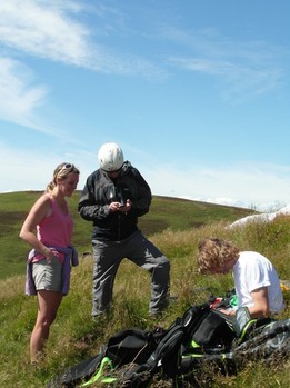
Photo: Helen Gant, Mike Cavanagh and Barney Woodhead exploring for new triangles in the Scottish Borders.


